
In 2025, Spexi fundamentally evolved as a platform. The LayerDrone Foundation was spun out of Spexi to steward the network and the community of pilots contributing to it, and now, Spexi is powered by LayerDrone. We’re the first value-added reseller of LayerDrone protocol data, and we’re proving that contributor-powered aerial imagery can operate at enterprise scale.
This year, Spexi and LayerDrone laid the groundwork for a decentralized aerial data network that rewards pilots directly for the imagery they capture. This is the infrastructure that will define the next decade of spatial intelligence. Thank you to every pilot who flew, every customer who trusted our data, and every community member who helped us navigate this evolution.
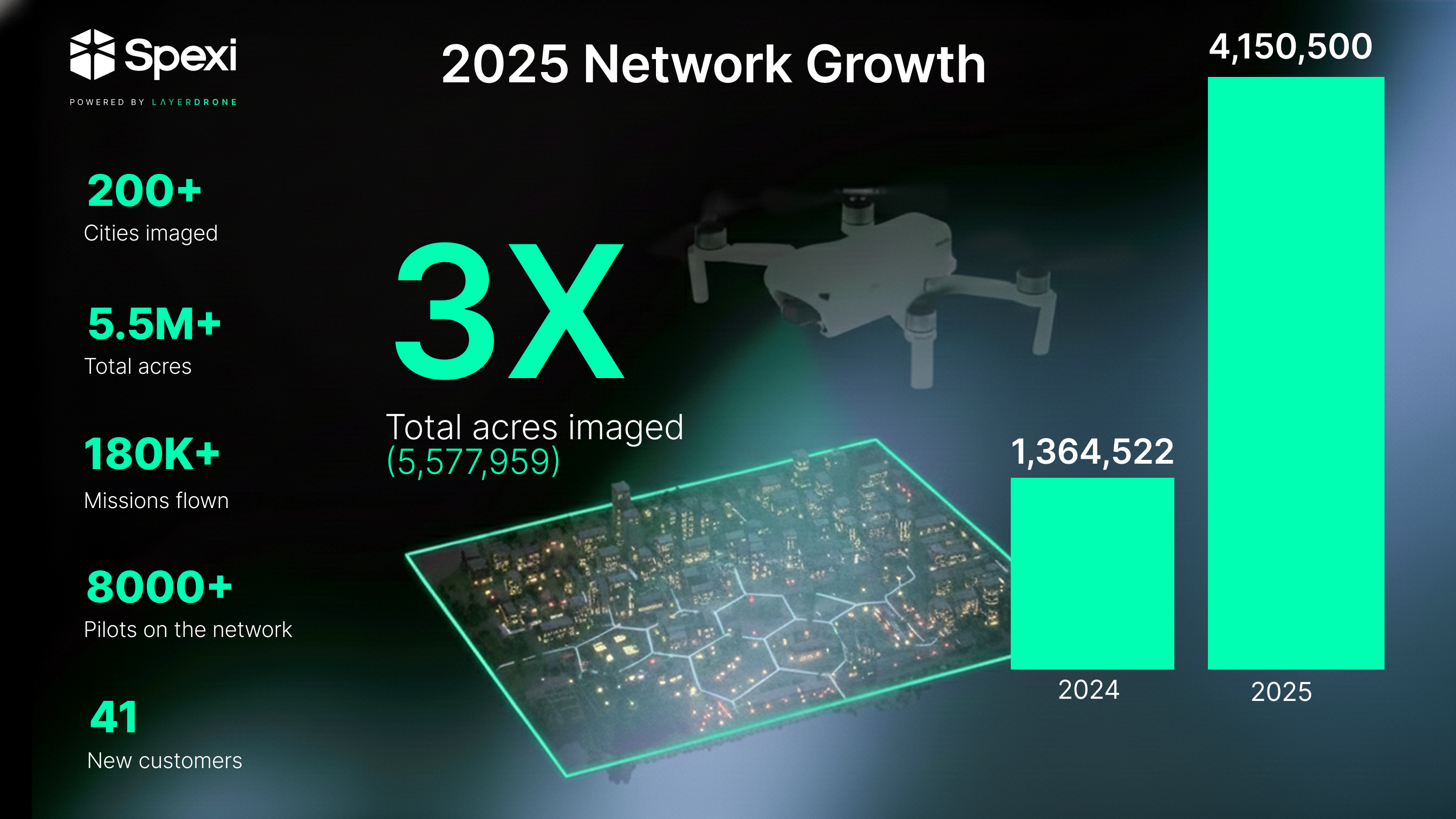
2025 was an exponential year for Spexi and the LayerDrone network.
These numbers represent the operational foundation that LayerDrone's decentralized protocol is built upon. Every mission flown this year contributed to both Spexi's commercial success and the broader LayerDrone network's proof of concept.
Spexi’s progress runs on the energy and consistency of the LayerDrone pilot community. In 2025,
The LayerDrone x Spexi Discord became the nerve center for pilots participating in weekly community calls, engaging with LayerDrone’s new Experience Points (XP), and preparing for the upcoming $DRONE token launch, and understanding how their historical contributions will be recognized in the Web3 transition.
In 2025, Spexi imagery moved beyond proof-of-concept into production workflows driving real business decisions.
A few of the use cases that proved the value of standardized, verified aerial data:
These use cases validated the core thesis behind Spexi as a platform: standardized, contributor-captured aerial data can replace expensive custom drone operations when the network reaches sufficient density and refresh rates.
.png)
January — Spexi + Airspace Link partnership
Spexi partnered with Airspace Link to support drone-based planning and inspection workflows, bringing high-resolution imagery into regulated airspace operations and urban environments.
April — LayerDrone Foundation launchedSpexi spun out its decentralized aerial imagery technology into the independent LayerDrone Foundation, supporting an open protocol for standardized, verified aerial imagery. Spexi remains a core contributor and the first value-added reseller of LayerDrone data.
August — Orthomosaic campaign rolloutSpexi rolled out large-scale orthomosaic campaigns alongside a new flight-planning workflow, enabling consistent, stitched, top-down imagery across wide areas for mapping, analysis, and GIS workflows.
Throughout 2025 — Spexi API release and expansion
Spexi introduced API access that allows teams to ingest imagery and metadata directly into their own tools and pipelines, supporting automated GIS, analytics, monitoring, and inspection workflows.
November — Spexi partners with SkyWatchThrough a partnership with SkyWatch, Spexi’s standardized drone imagery will soon become available via the SkyWatch Content Store and accessible inside some of the world’s largest geospatial software companies, expanding access for GIS professionals and enterprise users.
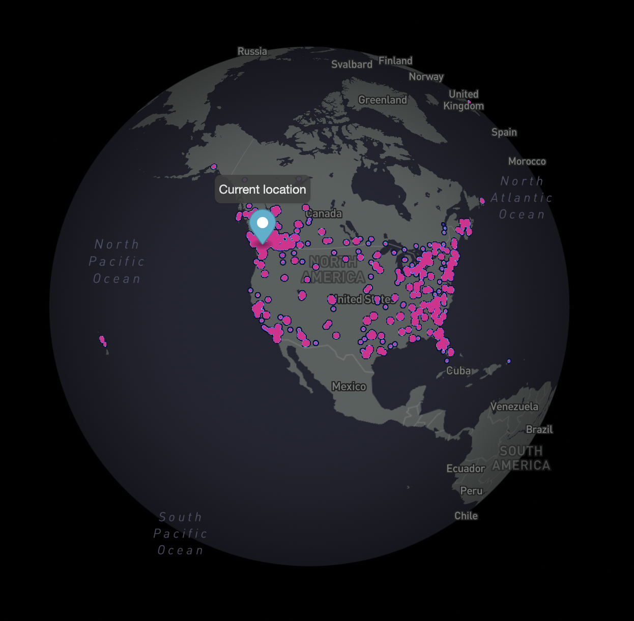
December — Open Capture Enables Largest Network Expansion EverNear the end of the year, Spexi launched the largest expansion in network history: The Open Capture Campaign. WIth 200,000+ drone missions across 40 southern US cities, each mission rewards ten-times the RP of a standard mission — enabling network expansion while testing non-cash incentives for pilots.
Late 2025 — Network scale milestones
By year end, the network passed 5 million acres imaged and 180,000 missions flown, marking major operational milestones for a contributor-powered aerial data network.
Together, this forms a growing historical record of an environment that becomes more valuable as coverage deepens and refreshes over time. This is the foundation LayerDrone's decentralized protocol is standardizing and opening to the world.
2025 was about proving the model works. 2026 is about scaling it exponentially.
With the LayerDrone Foundation now operational, the network’s 2026 token launch will transform how pilots engage with and benefit from the network. The new incentive mechanisms aim to improve the coverage of the network while fairly rewarding pilots and other community members for their contributions to the network.
For Spexi specifically, 2026 means:
Thanks again to everyone who supported Spexi this year — pilots, customers, partners, and the community.
—The Spexi team
