
Quickly compare candidate sites with high-res aerial imagery. Evaluate terrain, floodplains, access routes, and environmental constraints all before boots hit the ground.
Quickly compare candidate sites with high-res aerial imagery. Evaluate terrain, floodplains, access routes, and environmental constraints all before boots hit the ground.
%201.avif)
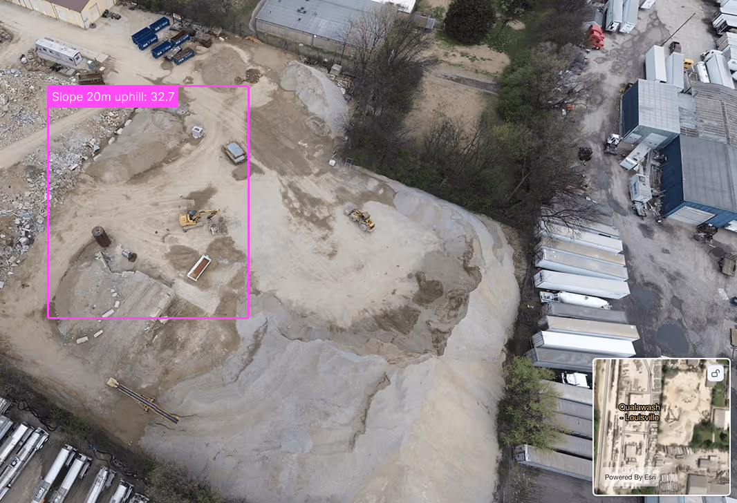
Generate topographic maps and elevation models with high quality imagery. Complete assessments without leaving your desk. Identify slopes, structures, and utilities early and start planning confidently.

Drop real site context into your 3D models and proposal decks. Give stakeholders accurate visuals from day one and win buy-in with clear, data-backed designs.
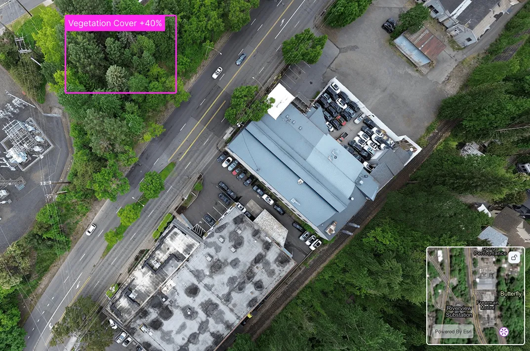
Monitor sensitive features like wetlands, vegetation, and runoff risks before and during construction. Stay compliant and keep regulators happy with real-time visual records.
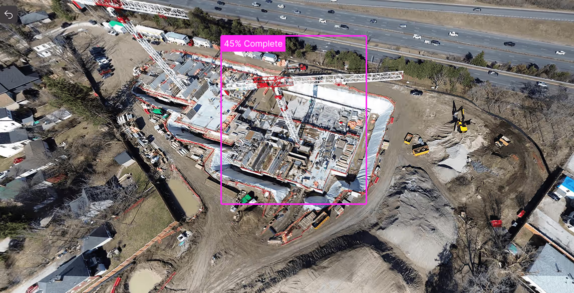
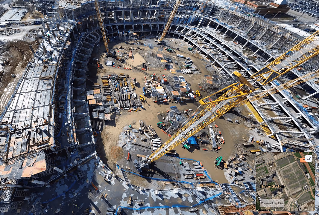
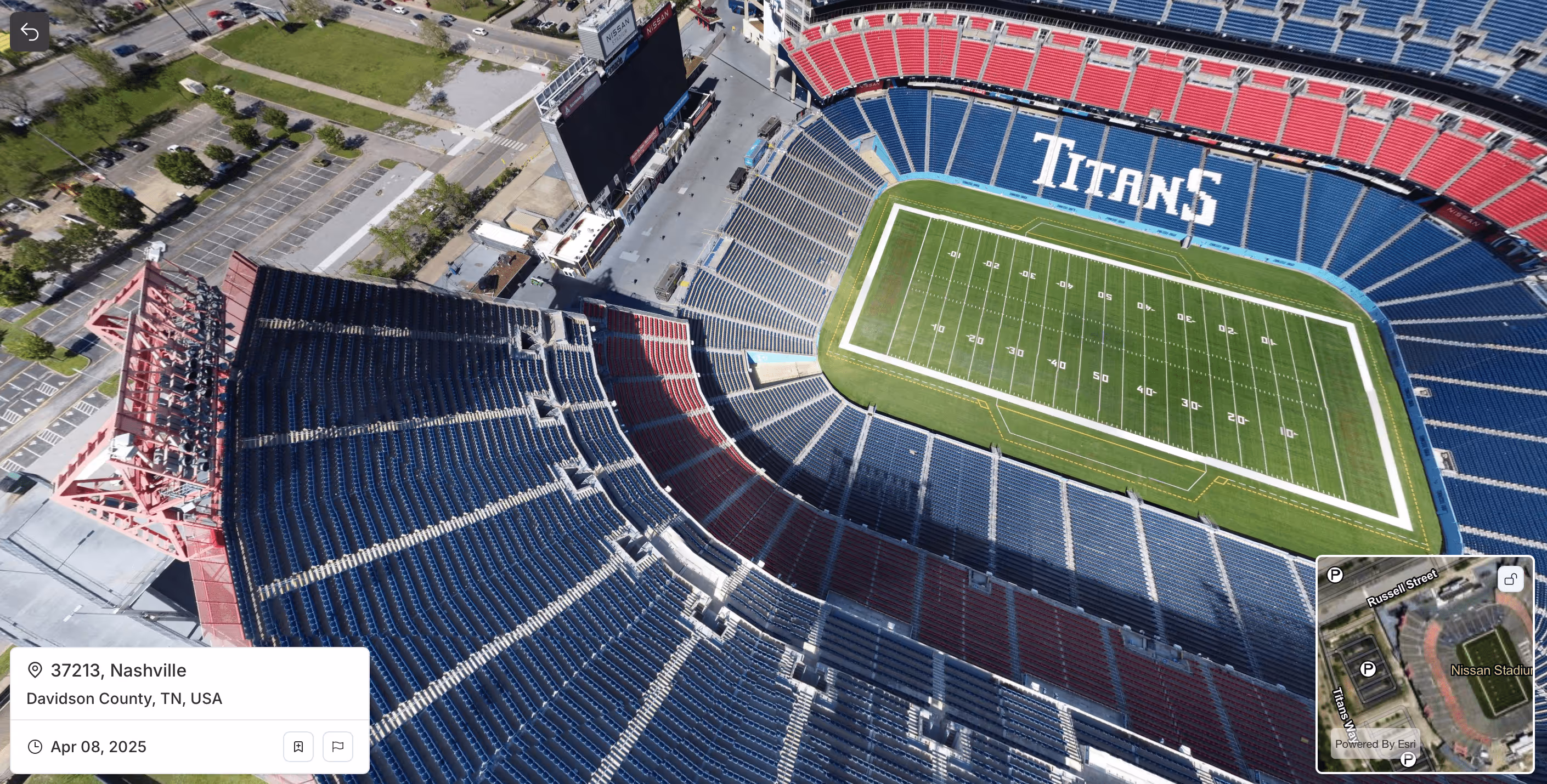
Track completion rates and measure volumes without walking the site. Spexi’s imagery helps you stay on schedule, spot safety issues, and coordinate crews with crystal-clear visuals.
Spexi taps into a network of drone pilots, each equipped to capture fresh aerial imagery. Our platform automates flight planning, data collection, and processing, so you get clear, detailed views on demand.
Only pay for the data you need—whether it's a single site or a city-wide scan, Spexi makes aerial imagery coverage scalable and cost-effective.
Pilots from Your Local Community. When you work with Spexi, you’re working with your local community.
Request on-demand imagery as often as needed delivered faster and with 97% less carbon impact than traditional flyovers.
Explore high-resolution aerial imagery through our browser-based World Viewer or plug directly into your workflow with our API.


For AEC platforms, general contractors, and infrastructure firms managing projects at scale. Our APIs give you fast, flexible access to high-resolution aerial data across your entire portfolio.

Get the aerial imagery you need, when you need it. Spexi delivers high-resolution aerial data in near real-time, enabling faster inspections, better disaster response, and smarter planning giving AEC firms the intelligence to act with confidence.

Put the latest aerial data in the hands of every stakeholder. Spexi’s browser-based map viewer makes it easy for teams to access, review, and act.

No matter who flies, standardized flight path and capture methods ensure reliable aerial data that delivers consistent imagery you can compare over time.

Whether it's a flood, fire, or infrastructure failure, Spexi enables AEC firms to request and receive up-to-date aerial imagery in hours or days, not weeks.

Pilots on the Spexi Network operate exclusively with sub-250g drones, allowing them to fly faster and with fewer regulatory hurdles. That means no lengthy approvals, less red tape, and quicker access to the imagery you need.
