
.jpeg)
Spexi and SkyWatch have partnered to make standardized, ultra-high-resolution drone imagery available to Esri and SkyWatch users for the first time. Through this collaboration, Spexi’s imagery products derived from its massive standadrized network will soon be available directly within Esri’s ArcGIS ecosystem via SkyWatch’s Content Store, as well as through SkyWatch EXPLORE and HUB.

This partnership represents a major step toward connecting decentralized drone data capture with enterprise-level access and usability.
For Spexi customers, it means easier access, broader integration, and faster delivery of standardized, high-resolution imagery—no special data requests or conversions required.
Spexi’s standardized orthomosaic products, derived from raw imagery collected through it's drone pilot network, can soon be browsed, purchased, and integrated directly into ArcGIS Pro, ArcGIS Online, and ArcGIS Enterprise environments.
This makes Spexi the first provider of standardized drone imagery at scale in North America available within the Esri ecosystem.
SkyWatch brings together multiple sources of Earth observation—satellite, aerial, and now drone imagery—into a single interface. The integration is expected to make data available to skywatch/Esri users in the coming months.
With the addition of Spexi’s ultra-high-resolution datasets, users can combine macro and micro perspectives seamlessly, creating a richer, more actionable view of the world.
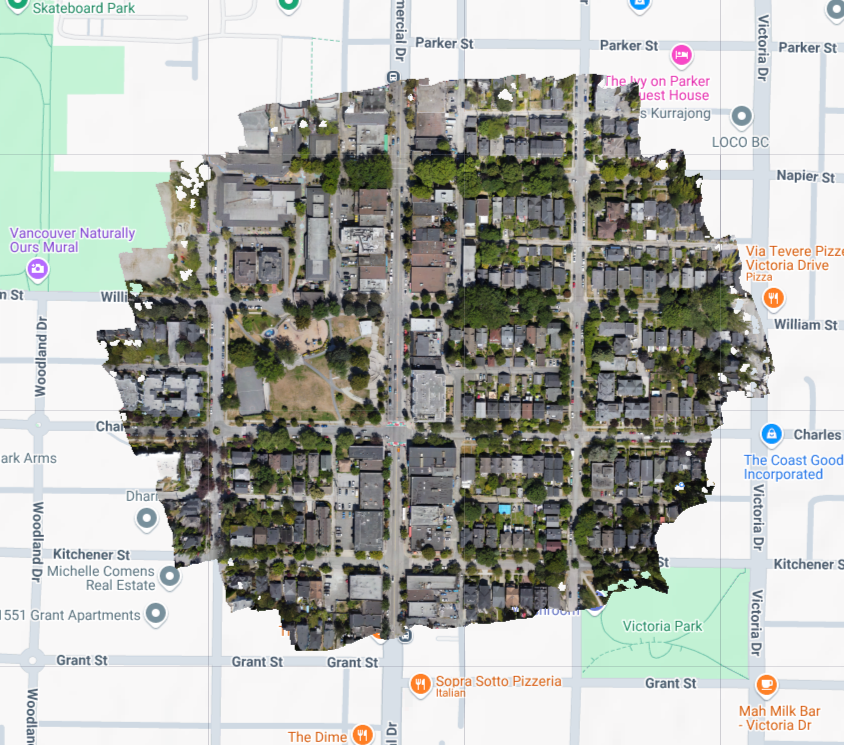
Spexi’s distributed network of pilots captures new imagery faster and in smaller areas—down to 25 acres—while maintaining up to 2.8-centimeter precision.
Through SkyWatch, that data. will reach more users, supporting use cases in disaster response, infrastructure monitoring, insurance, urban planning, and spatial AI.
Every dataset Spexi delivers adheres to a strict standardization framework for resolution, metadata, and processing quality.
This ensures that organizations can scale projects confidently across multiple regions and timeframes, knowing their imagery will align perfectly—whether captured last week or last year.

This partnership marks an important bridge between decentralized data collection and centralized access.
As the network continues to expand globally, Spexi will keep producing advanced imagery products—orthomosaics, 3D datasets, and AI-ready assets—that bring new precision and insight to Earth observation.
Through SkyWatch and Esri, that data will soon be available where it matters most: inside the tools professionals already rely on to make spatial decisions every day.
Spexi is proud to deliver the world’s most accessible, standardized drone imagery through partnerships that connect decentralized data capture with global distribution.
To explore Spexi imagery, visit SkyWatch’s Content Store or learn more at spexi.com.
