
Low Quality Data Is Bottlenecking Your AI Models
AI models are only as strong as their training data. Spexi equips Spatial AI teams with ultra-high-resolution, standardized, and up-to-date aerial imagery — so you spend less time cleaning data, and more time shipping results.
How Spexi Helps Spatial AI Companies Innovate
From computer vision pipelines to 3D reconstruction, Spatial AI companies rely on aerial imagery to train smarter models, reduce manual overhead, and accelerate deployment. Spexi delivers the ultra-high resolution, standardized drone imagery they need to power these workflows.
Computer Vision & Machine Learning
Poor-quality training data slows development, introduces errors, and leads to costly model remediation. Manually annotating, cleaning, and updating geospatial datasets is a massive time-suck. Spexi’s high-resolution imagery increases model accuracy, can help reduce false positives and negatives, and saves thousands of dollars in cleanup costs.
Simulation & Gaming
Low-resolution imagery creates static, unrealistic models which can cause expensive & slow post-processing. Generating accurate digital twins or immersive virtual environments often requires extensive manual cleanup. Spexi's on-demand capture provides the texture-rich detail needed for photorealistic, real-time environments.
Predictive Analytics
Models built on outdated or coarse-resolution imagery deliver weak predictions, unreliable risk forecasts, and delayed maintenance triggers. Spexi captures detailed imagery of roads, bridges, utilities, and facilities—boosting prediction accuracy, reducing downtime, and slashing maintenance costs.
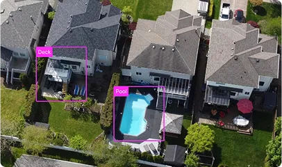
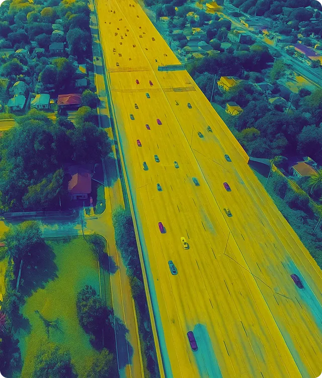
Object Detection & Image Segmentation
Detecting small or obscured objects is error-prone with standard imagery. Dense scenes, shadows, and low resolution lead to missed or mislabeled data. Spexi’s imagery improves object recognition rates and minimizes manual labeling bottlenecks, enabling more accurate classification.

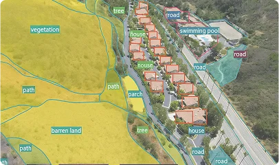
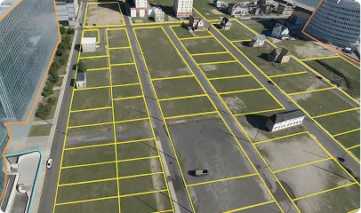
3D Mapping & Reconstruction
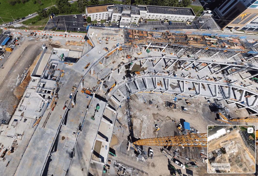
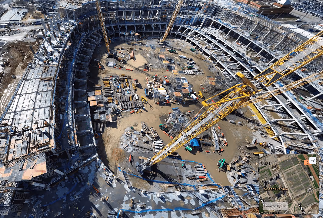
Building accurate 3D models with poor resolution or inconsistent image overlap leads to data gaps, geometric errors, and high post-processing overhead. Spexi provides imagery with sub-centimeter resolution and optimal overlap—ideal for photogrammetry and digital twin workflows.
Sharper Imagery, Stronger AI Models, Bigger Impact
Spexi taps into a network of drone pilots, each equipped to capture fresh aerial imagery. Our platform automates flight planning, data collection, and processing, so you get clear, detailed views on demand.
01. Spot Scans + Wide Coverage
Cost Effective Supply of Data. Whether it’s the entire city or just a neighborhood, only purchase the data you need.
02. Reinvesting in Your Local Economy
Pilots from Your Local Community. When you work with Spexi, you’re working with your local community.
03. Fresh Data, Whenever You Need It
Request up-to-date aerial imagery as often as needed— so you’re always making decisions based on the most current data available.
Trusted by AI Teams, Validated in the Real World
Explore high-resolution aerial imagery through our browser-based World Viewer or plug directly into your workflow with our API.
Get fast, flexible access to high-resolution aerial data with our APIs:

Technology That Scales With Your Models
Spexi delivers high-resolution aerial imagery, giving Spatial AI teams the foundation for faster training, more accurate inference, and scalable deployments.

Aerial Data Everyone Can Use, Instantly
From engineers to analysts, Spexi’s browser-based viewer makes it easy to access, review, and integrate imagery into your AI pipelines — no complex setup required.

Consistency You Can Trust, Across Every Flight
Standardized capture methods ensure reliable imagery every time, making datasets directly comparable across locations and time essential for model training and validation.

Deploy Drone Coverage in Hours, Not Weeks
Whether you’re training a new detection model or refreshing a digital twin, Spexi enables you to request and receive up-to-date imagery in hours or days, not weeks.

Built for Speed, Designed for Compliance
Our sub-250g drone network delivers compliant, standardized imagery at scale — removing bottlenecks, cutting down approvals, and giving you the high-quality data your AI can trust.
Smarter Decisions Start With Better Data
