X
spexi logo

Train Hivemind with the Clearest Real-World Aerial Data

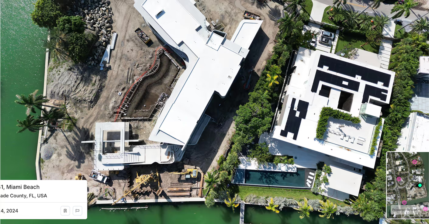
Spexi delivers ultra-high-resolution obliques & orthosmosaics that bring precision, clarity, and frequency to Hivemind’s training pipeline. When autonomous flight depends on vision, Spexi gives you the cleanest view possible.

Shield AIShield AI
Satellite Imagery
Spexi Imagery

How Spexi Elevates Autonomous Flight Systems

Icon

Improve Route Planning and Precision Navigation Testing

Spexi’s obliques, orthos, and Standard Image API supply the real-world data needed for flight simulations that actually match reality. Spexi’s Ultra-high resolution imagery helps autonomy teams validate route logic, optimize low-altitude pathfinding, and test navigation algorithms with real terrain.

Icon

Bolster Mission Validation with Updated Change Detection Models

Even the best imagery leaves gaps that limit model accuracy. Temporal data gaps cause model drift and data decay. Spexi’s time-series obliques deliver fresh visual intelligence so AI models can learn from real environmental changes; critical for mission validation, re-training, and target tracking accuracy.

Icon

Strengthen Terrain and Environmental Awareness

Relying on fixed-wing or satellite imagery means training autonomy systems on data that’s often weeks or months old. Spexi’s frequent, high-resolution aerial data provides the clarity and recency Hivemind needs to interpret terrain, identify hazards, and maintain precision.

Quietly Powering the Best in the Business

Spexi is trusted by leading governments, disaster response teams, and real estate professionals who need fast, verifiable, and sustainable imagery.

100,000+ successful missions
10+ million aerial images
200x faster than traditional surveys
50x more cost-effective

Delivery Options for Shield AI

Standard Image API — Starting at $299 / month

Integrate high-resolution obliques directly into Shield AI’s autonomy stack. Reliable, fast, and structured for real-time training and simulation pipelines.

Detailed aerial photo for smarter  decisions with Spexi

World Viewer

A secure, browser-based viewer for autonomy engineers and analysts to inspect, compare, and validate mission areas. Ideal for reviewing terrain features, change detection zones, and test environments before deployment.

Orthomosaic & Terrain Solutions

Geo-accurate stitched imagery and digital terrain models for autonomy development and mission rehearsal. Perfect for simulation-to-reality workflows and for training vision models on real-world topography.

Train Autonomy That Adapts as Fast as the Mission Changes

Every decision Hivemind makes depends on what it sees. Spexi keeps that view current, sharp, and true to the world it flies through. Build autonomy that learns faster, reacts sooner, and operates with confidence.