
X

Elevate Insurity’s Core Systems with the Sharpest Aerial View in Insurance
Bring ultra‑high‑resolution real‑world imagery into your policy‑to‑claims stack for unmatched precision, speed and competitiveness.
Bring ultra‑high‑resolution real‑world imagery into your policy‑to‑claims stack for unmatched precision, speed and competitiveness.

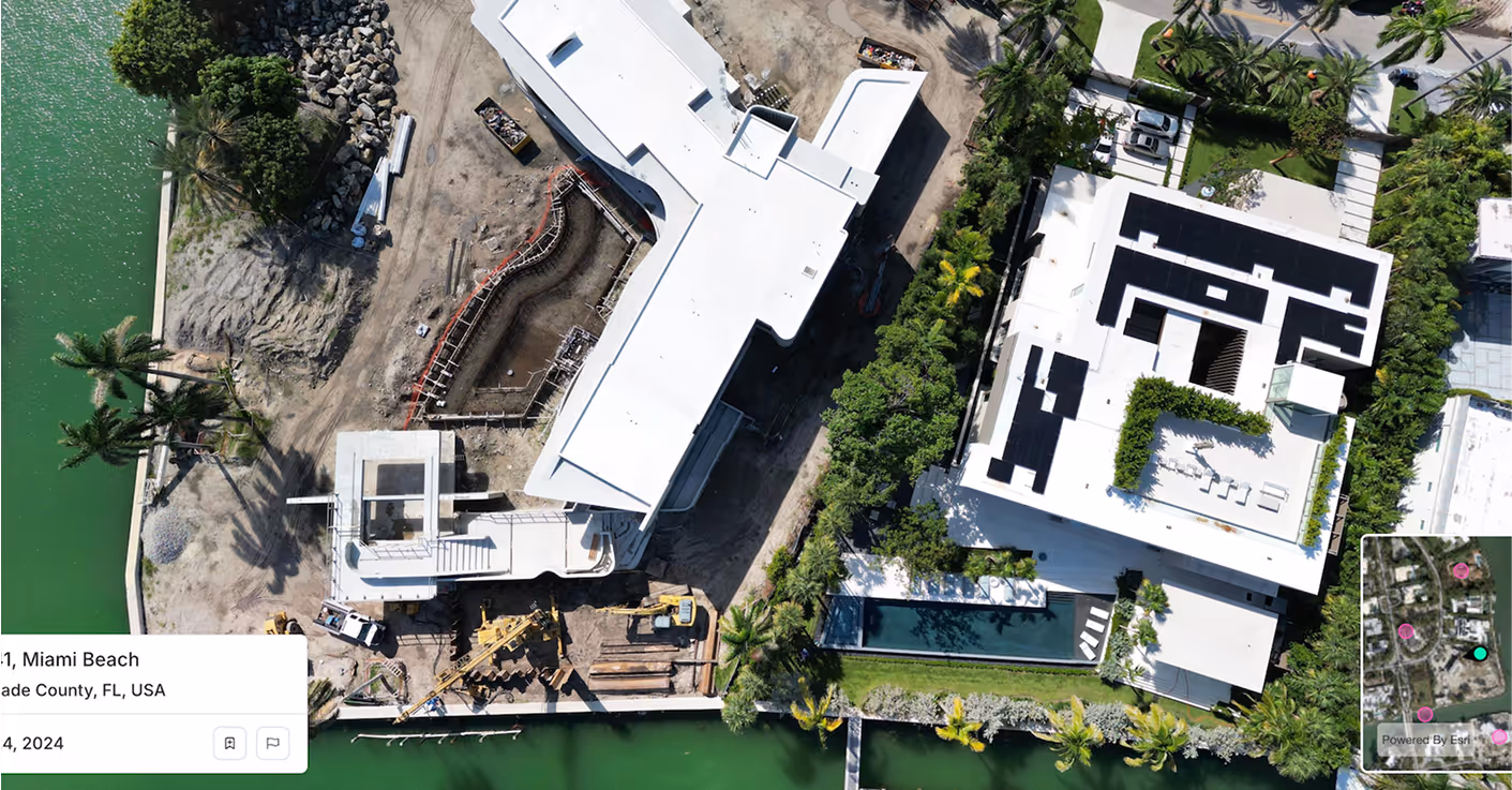
Spexi adds ultra-high-resolution drone imagery directly into Insurity Analytics, enriching your datasets with ground-truth visuals. Strengthen risk models, detect changes, and fill blind spots that satellite and fixed-wing data often miss.

Provide adjusters and analysts with fast, verifiable visuals. Spexi’s imagery embeds directly into SpatialKey to support CAT modeling, exposure analytics, and property validation, so teams can act quickly with total confidence.

Speed up claims and reduce LAE with timely, taskable imagery. Spexi enables remote inspections, site monitoring, and rapid FNOL triage, hence giving your claims team the power to see what’s happening on the ground, instantly.
Spexi is trusted by leading governments, disaster response teams, and real estate professionals who need fast, verifiable, and sustainable imagery.
.gif)

Integrate high‑resolution oblique and top‑down imagery directly into Insurity’s platform instances (Clarity, Claims, Loss Control). Reliable, fast and designed for enterprise scaling.
A browser‑based viewer for panoramas & oblique, ideal for claims adjusters, underwriting teams or loss‑control specialists who need to inspect, compare and validate properties visually.
Geo‑accurate stitched imagery and terrain datasets for portfolio‑wide coverage. Perfect for underwriting portfolios, exposure modelling and automated risk‑scoring workflows integrated into Insurity’s analytics layer.
Don’t let stale data hold back your underwriting, claims or loss‑control operations. Elevate Insurity’s analytics with Spexi imagery and build property intelligence that reflects reality.
.png)
