
X

Upgrade GeoX’s Property Intelligence with Pinpoint Imagery
Capture hyper‑local, ultra‑high resolution aerial imagery that turns every roof, parcel and structure into actionable insight.
Capture hyper‑local, ultra‑high resolution aerial imagery that turns every roof, parcel and structure into actionable insight.

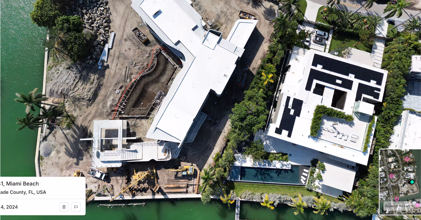
Spexi’s sub‑3 cm resolution imagery picks out micro‑cracks, missing shingles and early wear patterns invisible in standard capture. Time‑series imagery adds historical depth, letting GeoX extend its 20‑year database with fresh, high‑precision visuals.

Spexi’s aerial data plugs spatial‑gaps and brings current as‑built structure detail across portfolios. That means missing roof types, skylights, solar panels or structural changes get captured, enriching the database and reducing stale records.

Spexi supplies imagery refined for ML ingestion: standardized, georeferenced, API‑ready. This lets GeoX’s algorithms run on the freshest, sharpest data hence boosting accuracy, lowering model drift, and supporting faster decision‑making.
Spexi is trusted by leading governments, disaster response teams, and real‑estate professionals who need fast, verifiable, and sustainable imagery.
.gif)

High‑resolution oblique imagery for GeoX to integrate directly into its platform and database. Reliable, fast, enterprise‑scale.
Browser‑based viewer for panoramas & obliques; ideal for GeoX’s teams to inspect, validate or refine attributes visually.
Geo‑accurate stitched imagery and terrain datasets. Built for mapping or validating structural change over time across GeoX’s property coverage.
Bring unmatched visual clarity to every roof, parcel and property record. GeoX’s analytics deserve the sharpest possible view of reality.
.png)
