X

Power CARTO’s AI Agents With Precision Drone Imagery
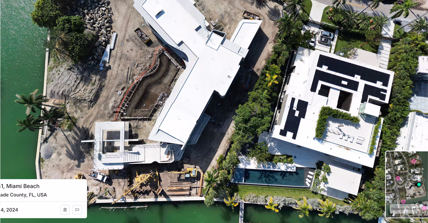
Spexi captures sub 3 cm clarity at scale, supplying CARTO workflows with crisp, on demand visuals that strengthen analysis and improve agent answers.
Spexi captures sub 3 cm clarity at scale, supplying CARTO workflows with crisp, on demand visuals that strengthen analysis and improve agent answers.

Spexi delivers sub 3 cm clarity for pre and post event analysis. CARTO’s CAT models gain sharper inputs for assessing structural damage, vegetation risk and ground conditions.

Spexi provides photorealistic views of parcels, rooftops and surrounding land use. CARTO users can compare sites with real world context, improving scoring and location decisions.

Spexi’s high resolution imagery adds granular detail to density, access and environmental patterns. CARTO workflows get more accurate ground truth for optimizing routes and designing fair service zones.
Spexi is trusted by leading insurance companies, disaster response teams, and real estate professionals who depend on fast, verifiable, and scalable imagery for high-stakes decisions.
.gif)

Drop high-resolution obliques directly into your CARTO data warehouse connections. Clean formatting. Fast delivery. Enterprise friendly.
A browser viewer for panoramas and obliques. Ideal for teams who need to visually inspect, compare and validate locations before running spatial workflows or agent prompts.
Geo-accurate, cloud-delivered orthomosaics at sub-3 cm resolution. Perfect for model validation, simulation tuning, and scenario comparison inside CARTO Workflows and Analytics Toolbox.
Give your AI Agents the clarity they need. CARTO’s data ecosystem becomes even more powerful when it includes on-demand, high-resolution imagery from Spexi.
.png)