X
spexi logo

Bolster BriteCore’s Analytics with the Sharpest Aerial Data

In your 2025 Core Systems Report, 86% of carriers said analytics is critical, but only 56% are satisfied. That gap starts with outdated data. Spexi gives BriteCore the clearest, most current view of every parcel, policy, and claim. Hence Eliminating temporal data gaps and stopping data decay before it skews decisions.

BriteCoreBriteCore
Satellite Imagery
Spexi Imagery

How Spexi Elevates BriteCore’s Core Products

Icon

Generative AI

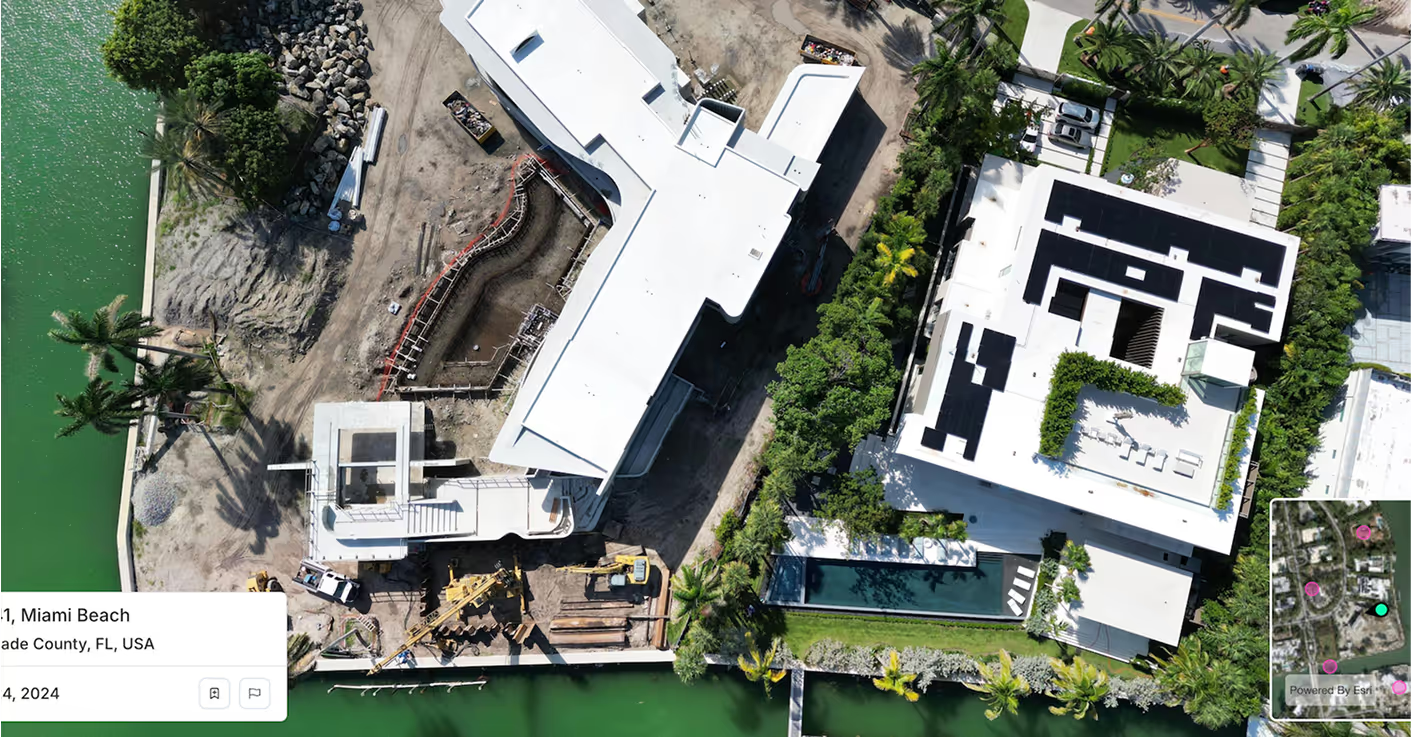
BriteCore’s AI features get sharper with Spexi’s sub-3cm resolution imagery. Reveal roof damage, property changes, and lot obstructions with unmatched clarity. Give your models a true ground truth for better anomaly detection, risk scoring, and automated labeling.

Icon

BI & Analytics

On-demand aerial refreshes keep your insights current. Spexi delivers fully standardized, machine-ready imagery that's more timely and affordable than satellite or fixed-wing data. Keep your dashboards accurate and your models learning with visual context you can trust.

Icon

Claims Management

Give adjusters clear before-and-after views of specific loss locations. Spexi captures hyper-local datasets down to 25 acres, helping teams validate claims faster, reduce leakage, and make better decisions without ever stepping on-site.

Quietly Powering the Best in the Business

Spexi is trusted by leading governments, disaster response teams, and real estate professionals who need fast, verifiable, and sustainable imagery.

100,000+ successful missions
10+ million aerial images
200x faster than traditional surveys
50x more cost-effective

Quietly Powering the Best in the Business

Standard Image API, Starting at $299/month

Integrate high-resolution oblique imagery directly into BriteCore’s platform. Reliable, fast, and built to scale with your enterprise needs.

Detailed aerial photo for smarter  decisions with Spexi

World Viewer

A browser-based viewer for panoramas and obliques. Perfect for underwriters, claims teams, and analysts who need to inspect and compare properties visually.

Orthomosaic Imagery Solutions

Geo-accurate stitched imagery and terrain datasets for national property coverage. Built for high-volume analysis, catastrophe response, and automated workflows.

Bring Visual Intelligence to BriteCore

Turn every claim, quote, and policy decision into a high-fidelity risk snapshot. BriteCore’s smart systems deserve a real-world view.