Learn how to integrate standardized drone imagery within ArcGIS support infrastructure, development, and planning workflows.

Webinar:
Drone imagery for city operations,
in ArcGIS
May 19 2026
11:00 - 11:30 AM PT
Thank you! Your submission has been received!

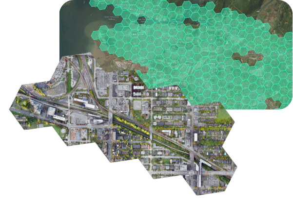
Flexible, on-demand visibility for city operators
City teams often lack a consistent, up-to-date view of infrastructure, development,
and on-the-ground conditions, making it harder to act early and coordinate across departments.
Join our webinar to explore how to access high-resolution drone imagery directly in ArcGIS, so you can monitor infrastructure, track development, and support planning with current, on-demand data.
What you’ll learn
How Spexi enables better planning, asset management, and public works.
Practical ways to bring ortho and oblique image products
into municipal ArcGIS workflows.
How to access and purchase Spexi imagery
through the ESRI content store.

Get a clear view of city operations in ArcGIS. Register now.
Who Should Attend:
GIS Managers
Public Works & Infrastructure teams
Urban Planning & Development teams
Engineering & Capital Projects teams
Emergency Management & Operations
Event Details:
Date : May 19 2026
Time : 11:00 AM PT
Duration : 30 Minutes
Location : Remote

Why Attend
Get a clearer, more consistent view of asset conditions throughout your city.
Learn how to access high-resolution drone imagery on demand in ArcGIS so you can act earlier, coordinate better, and make more informed decisions.
About Spexi
Spexi provides high-resolution, real-world aerial imagery on demand, helping cities capture a clear, consistent view of infrastructure and development. Data is delivered in days and integrates directly into GIS platforms like ArcGIS, so teams can monitor change and make better decisions across city operations.
